By Dr Loÿc Vanderkluysen, Drexel University
A deadly earthquake
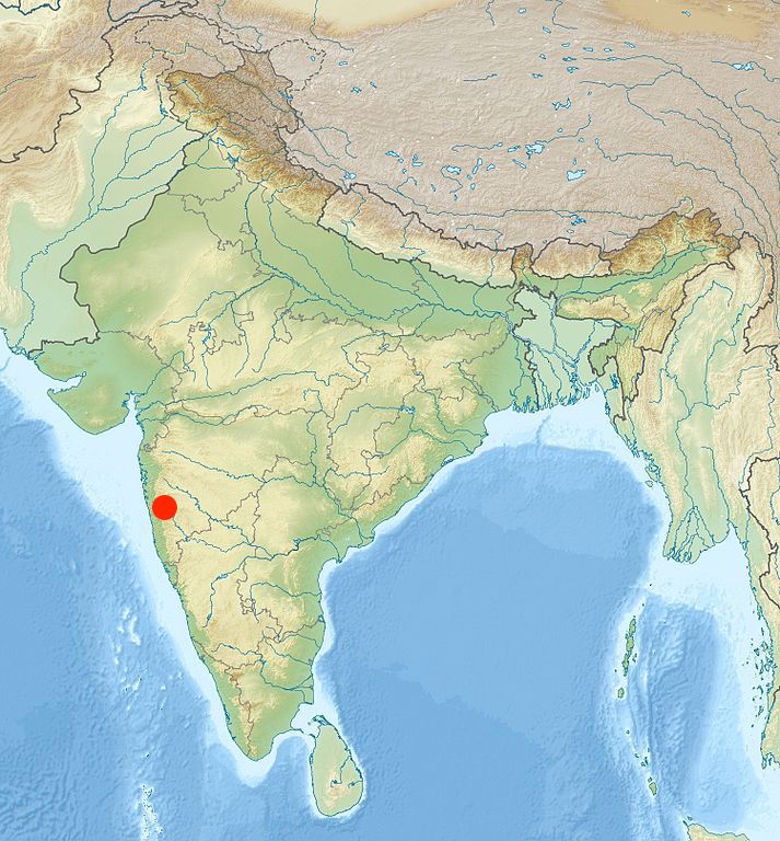
The small town of Koynanagar, nestled among the steep hills of the Western Ghats range of India, attracts visitors from miles around with its lush botanical gardens and waterfall vistas. Shortly before sunrise on the 11th of December 1967, farmers readied their oxcarts, and at the market, fires were lit to prepare the day’s first cup of chai. Then the ground started to shake. A crack 15 miles long split the ground open as shelves toppled and buildings collapsed. Within a few minutes, the small hill town had been leveled: 80% of buildings had collapsed, killing more than 170 people and injuring thousands.

Geologists have puzzled over the events of that 1967 Monday morning for the past five decades. There are no known major faults in the area and, prior to the 1960s, seismicity was practically non-existent. Below the surface, the ground is made up of basaltic lava flows from the Deccan Traps sequence, directly overlying a thick basement of gneisses and granites; in other words, a stable continental interior far from the destructive tectonic stresses that characterize earthquake-prone regions around the world. What could have caused a magnitude 6.6 quake?
More puzzling still: in the last fifty years, many more earthquakes have struck the area, including 22 of magnitude greater than 5.0, and hundreds of magnitude greater than 4.0. The sharp rise in seismicity following the completion of the nearby Koyna dam and filling of the Koyna reservoir in 1962 offered an easy culprit, and quickly the dam was blamed for the region’s woes. Though contentious in the 1960s, a large body of literature now exists documenting so-called “induced” seismicity, that is, generally minor earthquakes triggered by human activity, including mining, groundwater pumping, and fracking. Reservoir-induced seismicity, known since the 1930s, can be triggered by the accumulation of water in dammed lakes, with the added load of the water column causing changes to local stresses. If caused by the Koyna dam, the magnitude 6.6 Koynanagar earthquake would be the largest reservoir-induced quake ever recorded.
In 1993, the completion of another dam and impoundment of the Warna reservoir just south of Koyna triggered another spike in seismicity, and renewed interest in the mechanisms of the 1967 quake. The Indian government and partner institutions initiated an ambitious project to study the source of seismicity in the Koyna region by installing instruments deep within in the crust, at the bottom of dedicated boreholes.
The case for scientific drilling
Rock drilling has been part of human history for more than 4000 years, primarily for the purpose of reaching sources of drinkable water. Modern drilling tools were developed in the mid-1700s as the first oil-exaction wells were established. Because drilling can access rocks at depths or in environments that humans cannot reach, it has become an invaluable tool for the scientific exploration of the Earth’s crust, and even other bodies in the solar system: in 1971, the crew of the Apollo 15 mission collected a core of the lunar crust almost 8 feet in length. The deepest hole ever drilled is the Kola Superdeep Borehole in northwestern Russia. A point of Cold War pride, it reached a depth of over 12 km (40,230 ft).
Instruments placed deep in boreholes have provided invaluable information about the flow of groundwater and the Earth’s heat flow. More recently, geoscientists have begun exploring the possibility of drilling through some of the Earth’s most active faults. Although this likely evokes Hollywood-level nightmare scenarios, in reality there is much to learn from instrumentation placed near active faults. Measurements of built up stress and deformation, for instance, can help us understand and mitigate earthquake hazards. Started in 2004, the San Andreas Fault Observatory at Depth (SAFOD) pioneered borehole fault observatories, and more have now been installed at some of Earth’s most destructive fault systems, such as the North Anatolian fault in Turkey (source of the devastating 1999 Izmit earthquake). Building on the success of these deep borehole observatories, the Koyna drilling program was initiated with the objective of unraveling the source and mechanisms of the Koyna-Warna earthquakes.

The Koyna drill cores and the Deccan Traps
Perhaps coincidentally, the Koyna program happened to drill through hundreds of meters of lava flows from the Deccan Traps volcanic province. Although the stated aim of the project was to install deep borehole instrumentation to understand and monitor local seismicity, project scientists were well aware of the potential goldmine a drilling project through the massive volcanic lava pile could provide for understanding events at a keystone moment in Earth’s history: the end-Cretaceous mass extinction that saw the demise of non-avian dinosaurs and a wealth of animal and plant species across the world’s continents and oceans.
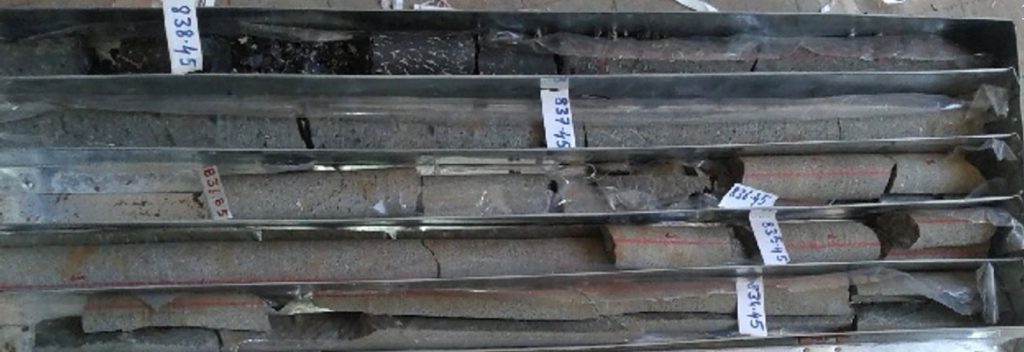
At first, scientific drilling through massive volcanic provinces like the Deccan Traps can seem like a counterproductive enterprise: drill holes are very small and very few in number compared to the vastness of these provinces, so much so that the venture has occasionally been compared to “pin-pricking an elephant.” But drill cores do provide advantages over surface outcrops: they represent a continuous record of the volcano’s activity without interruptions by roads or vegetation, and can reach depths below sea level that would not be otherwise accessible. Of the nine boreholes drilled for the Koyna project, all exceeded 900 m (2,950 ft) and four reached 1,500 m (4,920 ft), the most continuous sections ever observed across the province, from the contact with the underlying granitic rocks to the summit of the lava pile.
With participation from the International Continental Drilling Program (an organization dedicated to continental drilling to answer scientific questions that would not easily be tackled without drilling), the Indian government has now made the Koyna cores available for study by our team as well as other international scientists. There is little doubt that the end-Cretaceous boundary is located somewhere in the lava flow sequence of the Koyna cores, and we’re thrilled to have access to such an amazing geological record of volcanism at that time. Having access to the Koyna cores opens tantalizing opportunities to test hypothesized links between the Chicxulub impact and a rapid acceleration of volcanism in the Deccan!
References
Gupta, H.K., Arora, K., Rao, N.P., Roy, S., Tiwari, V.M., et al. 2017. Investigations of continued reservoir triggered seismicity at Koyna, India. In: Mukherjee, S., Misra, A.A., Calvès, G. & Nemčok, M. (eds) Tectonics of the Deccan Large Igneous Province. Geological Society, London, Special Publications 445, pp. 151-188.
